 |
|
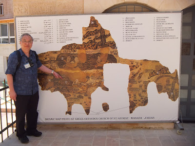
I am pointing to Jerusalem on a
replica of the Madaba Map |
Madaba is about 32 km south of Amman. It was a
Moabite town that was captured from Sihon the Amorite by the Israelites
(Num 21:30). We went there to see the Madaba Mosaic Map. This map is a
floor mosaic on the floor of St. George’s Greek Orthodox Church which
was built over a Byzantine church which was erected around the 6th
century. It is believed to be the oldest surviving map of the Holy Land.
As buildings erected in Jerusalem after 570 CE are conspicuously absent,
it was probably created between 542 and 570 CE. The floor mosaic was
rediscovered in 1896.
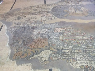
This map is unique in that east is facing the top and
Jerusalem is in the centre. Jerusalem was portrayed in great details. In
February 2010, further excavations in Jerusalem substantiate the
accuracy of this map with the discovery of a central road that runs
through Jerusalem. The Church of the Holy Sepulchre or the Church of the
Resurrection was laid in the centre of Jerusalem. Aside from being a
geographical map, it is also a theological map which portrays the
resurrection as the focus of Christian beliefs. As we look at the
surviving portions of mosaic map in the church, I cannot help but have a
sense of history encompassed by the territories involved. I also admired
how the focus of the map is on Jerusalem and not on the surrounding
landscapes. It conveys a sense of spiritual attraction towards
Jerusalem.
This sense of focus and being drawn toward the divine
is further enhanced by the icons on the walls, pillars and the wall of
icons in this beautiful Greek Orthodox Church. I feel a sense of
continuity with millions of pilgrims who were drawn to Jerusalem in the
Holy Land.
 |
|
St. George's Greek Orthodox
Church, Madaba |
 |
Laying between the present
northern limit of the central fragment of the map and the vignette
depicting Jerusalem we find the territory of the tribe of Ephraim (Lot
of Ephraim) and Benjamin (Lot of Benjamin).
|
 |
|
part of the map showing Jerusalem |
 |
|
part of the map showing Jerusalem |
 |
|
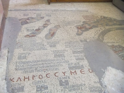
the Sinai Peninsula with a
mountain situated between the Negev in Palestine and the Egyptian
Delta. |
 |
|
In an isolated fragment of the
mosaic there has been preserved the port of Askalon on the
palestinian coast. The vignette of the city shows a network of
colonnaded and porticoed roads. Outside the city walls there is
the shrine of the Egyptian Martyrs, Ares, Promos and Elijah,
which was venerated by the pilgrims. |
 |
|
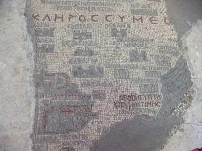
Three roman forts, Praesidium,
Thamara and Moa have been placed by the mosaicist in
the valley of Arabah to the south of the Dead Sea. These forts
guarded the roads which joined the edomite territory to the
palestinian coast crossing the Negev which is graphically
represented by three isolated mountains. |
“I saw the Holy City, the new Jerusalem, coming down out of heaven
from God, prepared as a bride beautifully dressed for her husband.
And I heard a loud voice from the throne saying, “Look! God’s
dwelling place is now among the people, and he will dwell with them.
They will be his people, and God himself will be with them and be
their God. ‘He will wipe every tear from their eyes. There will be
no more death’ or mourning or crying or pain, for the old order of
things has passed away.”” -Revelation
21: 2-4


